Segmentation is useful for identifying individual components in images. This project looked at identifying trees in heightmaps of orchards. Two main techniques were used: watershed segmentation, which uses a threshold function to classify areas, and simple linear iterative clustering (SLIC), which clusters pixels based on proximity and colour.
Terrain can be described as:
a) Flat
b) Gently sloped
c) Steeply sloped
d) Large hilled
e) Small hilled
Each of the above catergories can also be described as:
i. Smooth
ii. Noisy and disperse
iii. Noisy and compact
The following graph shows the results of an IOU evaluation of the system developed.
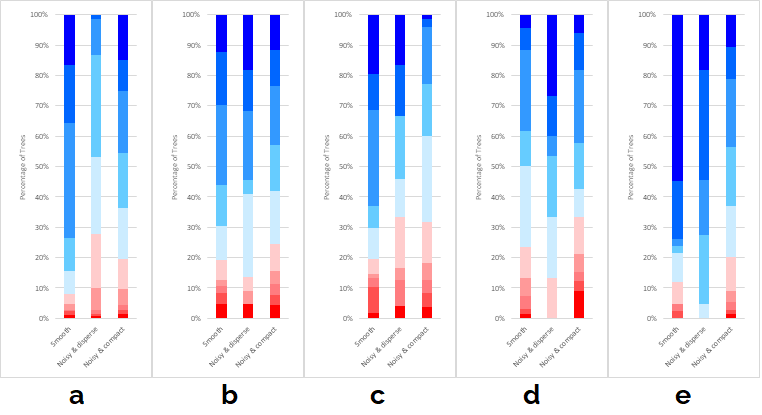
Figure 1: A series of graphs showing the percentages of trees that obtained a certain IOU percentage (shown in the legend), when using different subcategories of terrains in the flat terrain (a), gentle terrain (b), steep terrain (c), large-hilled terrain (d) and small-hilled terrain (e).
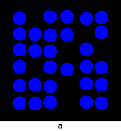
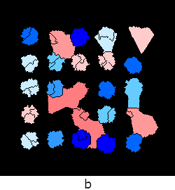
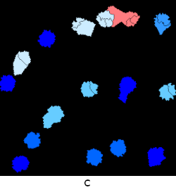
The following tree masks visualise the segmentation output and also display accuracy of the algorithm.
Figure 2: A series of images showing the tree masks produced, and their IOU percentage (as shown in the legend above), for the flat terrain (a), steep terrain (b), large-hilled terrain (c) and small-hilled terrain (d).
created with
Website Builder Software .